Outdoors
Swimming holes and lakes near Asheville
Lakes, rivers and beaches near Asheville where swimming is allowed on public land.
13places to swim
1 mito the closest
8within 30 miles
May–Septemberbest months
Good to know: Most natural swimming areas have no lifeguard; check water-quality advisories and current conditions before swimming.
Closest picks
Lake Powhatan
9 mi southwest · USDA Forest Service
Glamping sites are now available at Lake Powhatan! Experience nature and outdoor recreation without sacrificing the comforts and luxuries of home.
Lake Powhatan Glamping
9 mi southwest · USDA Forest Service
Located just minutes from the popular city of Asheville, North Carolina, Lake Powhatan Glamping is the perfect, all inclusive getaway.
Map of all 13 places
Map of 13 places loads as you scroll.
Within 30 miles (8)
National Forests in North Carolina
- Biking
- Boating
- Camping
- Climbing
- Fire Lookouts/Cabins Overnight
- Fishing
- Hiking
- Horse Camping
Lake Powhatan
Glamping sites are now available at Lake Powhatan! Experience nature and outdoor recreation without sacrificing the comforts and luxuries of home.
- Backpacking
- Birding
- Camping
- Fishing
- Hiking
- Mountain Biking
- Mushroom Picking
- Photography
Lake Powhatan Glamping
Located just minutes from the popular city of Asheville, North Carolina, Lake Powhatan Glamping is the perfect, all inclusive getaway.
- Accessible Swimming
- Antiquing
- Biking
- Camping
- Fishing
- Hiking
- Mountain Biking
- Mushroom Picking
North Mills River
North Mills River Campground is a rustic mountain getaway in Pisgah National Forest in western North Carolina.
- Camping
- Fishing
- Hiking
- Swimming
- Water sports
Black Mountain Campground
Black Mountain Campground sits in the shadow of Mt. Mitchell, the highest peak in the eastern U.S. and borders the South Toe River. Black Mountain is a mecca for the outdoor enthusiast.
- Biking
- Camping
- Climbing
- Fishing
- Hiking
- Ranger programs
- Swimming
White Pine South Group Camp
White Pine South Group Camp is one of two group campsites nestled along Avery Creek in the lush forests of the Appalachian Mountains.
- Biking
- Camping
- Fishing
- Hiking
- Swimming
Carolina Hemlocks Rec Area
Carolina Hemlocks Recreation Area sits in the scenic mountains of Pisgah National Forest. This is a great place for small to medium-sized groups to swim, fish, tube, hike, camp, picnic and simply relax in the cool shade of the forest.
- Biking
- Camping
- Climbing
- Fishing
- Hiking
- Picnicking
- Ranger programs
- Swimming
Davidson River
Davidson River Recreation Area offers camping and outdoor activities for the whole family.
- Camping
- Fishing
- Hiking
- Ranger programs
- Swimming
- Water sports
75 miles and farther (5)
Buckhorn Lake
Buckhorn Lake, KY is situated in the Cumberland Plateau of eastern Kentucky. This is an area that possesses a landscape as rugged as any found in the State.
- Boating
- Camping
- Fishing
- Hiking
- History
- Hotel/Lodge/Resort Privately Owned
- Nature education
- Picnicking
Chattahoochee-Oconee National Forest
- Biking
- Boating
- Camping
- Fire Lookouts/Cabins Overnight
- Fishing
- Hiking
- Horse Camping
- Horseback riding
Lake Sidney Lanier
Nestled in the foothills of the Georgia Blue Ridge Mountains lies Lake Sidney Lanier, one of America?s favorite lakes. Over 7.5 million people a year choose to visit Lanier.
- Biking
- Boating
- Camping
- Fishing
- Hiking
- Horseback riding
- Hotel/Lodge/Resort Privately Owned
- Nature education
Cherokee National Forest
- Biking
- Boating
- Camping
- Fire Lookouts/Cabins Overnight
- Fishing
- Hiking
- Horse Camping
- Horseback riding
Big South Fork National River & Recreation Area
Encompassing 125,000 acres of the Cumberland Plateau, Big South Fork National River and Recreation Area protects the free-flowing Big South Fork of the Cumberland River and its tributaries.
- Biking
- Boating
- Camping
- Climbing
- Fishing
- Hiking
- History
- Horse Camping
Distances are straight-line miles from downtown Asheville. Listings come from Recreation.gov’s federal recreation database; check each official page for hours, fees, fire restrictions and closures before you go.
Get outside around Asheville
THINGS TO DO · YOUTUBE SHORT
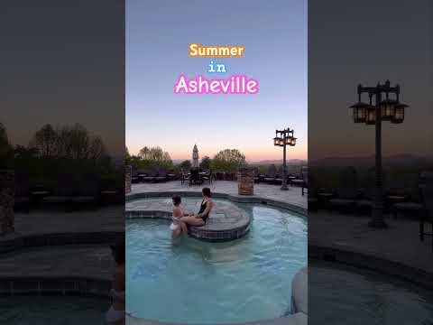
Experience a summer in Asheville
A local activity Short shared by Asheville.
Watch on YouTube ↗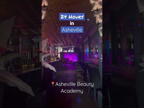
THINGS TO DO · YOUTUBE SHORT
Here’s how you can spend a day in
A local activity Short shared by Asheville.
Watch on YouTube ↗Around Asheville


More outdoors near Asheville
Questions
Where is the closest place for swimming near Asheville?
National Forests in North Carolina (USDA Forest Service), about 1 miles northwest of Asheville as the crow flies. Next are Lake Powhatan (9 mi) and Lake Powhatan Glamping (9 mi).
When is the best time for swimming near Asheville?
Based on Asheville’s average highs, May–September. Conditions at higher elevations can be much cooler.
Who manages these places?
Federal agencies including USDA Forest Service, US Army Corps of Engineers, National Park Service. Each listing links to its official page for hours, fees, closures and current conditions.